4 hour return | Marlborough
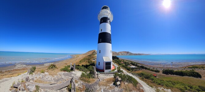
I had seen a post online around the Cape Campbell Lighthouse and how the Kaikoura earthquake had changed the surrounding rocks. I hadn't been before, so had no comparison, but was interested to see the place for myself, as the image of the striped lighthouse perched on the tip of a rocky outcrop is really how you would imagine a lighthouse to look if drawing it as a child.
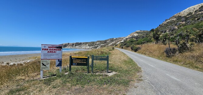
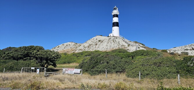
The track starts at the end of the road, around 300m after the Marfells Beach Campsite. You drive straight through the campsite to get there (also a great overnight option if you are wanting a place to stay). You can drive right through to the car park (beyond the signs pictured above) or can park here and walk along the beach.
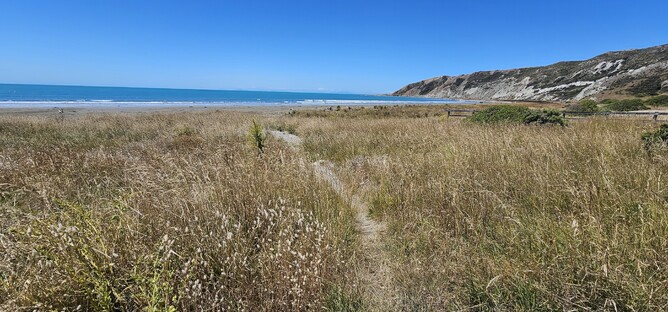
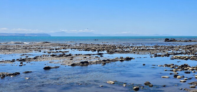
I started at the car park at the end and headed through the grass covered dunes to the beach. Turning right, I started my walk along the beach towards the lighthouse. I got lucky with a beautiful blue sky day, though there was still a bit of haze around which restricted visibility slightly in the distance.
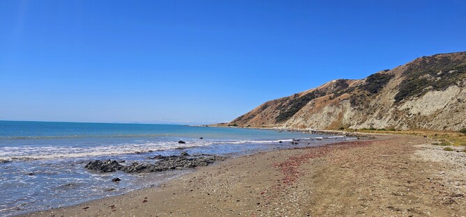
The first point that you are aiming for is Mussel Point (seen above). It took me around 20 minutes to get there, so I thought I was flying and would smash the suggested 2 hours to the lighthouse. I was a little optimistic with that thought though as the next section took a lot longer than I thought.
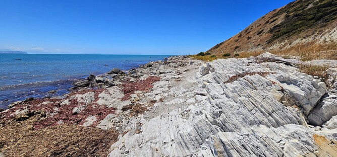
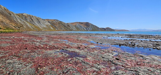
As you move from the beach to the gravel road, there are some great rock formations that stand out against the bright blue of the ocean and make great perches for the birds that call this place home.
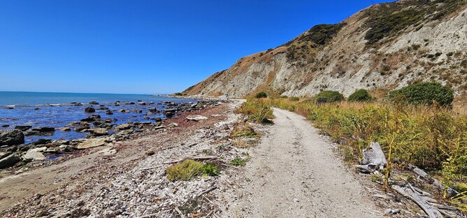
Up to Mussel Point you are on pretty well hardened sand or gravel road which is easy to walk on. As you approach the point, the gravel road becomes less dense where the high tide has loosened the surface and walking requires a little more energy.
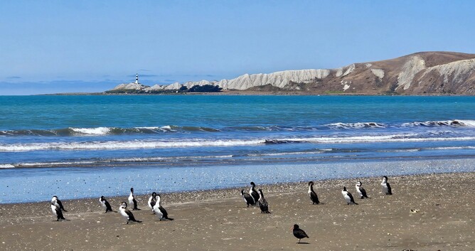
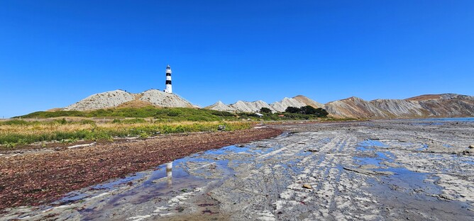
From here you get your first proper view of the lighthouse which sits at the end of the ridge. It doesn't look too far away, but depending on how low the tide is will determine how far round you need to walk to get there. I was walking as the tide was still going down, so on the way to the lighthouse my feet were still getting wet occasionally. On the way back, I was able to take a much shorter route without getting wet.
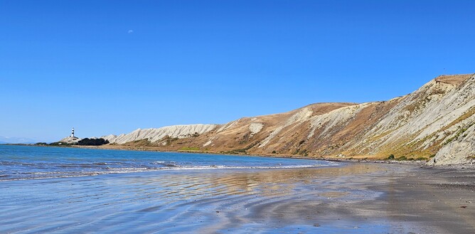
Whilst the scenery doesn't change all too much and you are walking on the beach the whole way, it does feel like you do have something new to see with every step. The light changes, or the beach moves from stone to sand, or the water is retreating and reflecting the ridge line. I really enjoyed it and found that it looked completely different on the way back to the way out.
With the tide still receding, the last section of my walk included picking my way along slippery, water covered rocks, trying to avoid the large patches of red seaweed. A gate and style mark the entrance to the lighthouse grounds, where you will find a number of panels with explanation as to the history of the lighthouse and the cottages around it.
This lighthouse was built in 1903to replace the original, built in 1870 and forming a prominent point to mark the lowest edge of the Cook Strait. A flight of stairs leads to the lighthouse entrance and gives you great views out to the surrounding ocean and back across Marlborough.

Before returning via the same route, I left the lighthouse compound and headed back out onto the beach. I continued past where the lighthouse stood in order to get a look back onto the lighthouse from beyond. This is definitely a worthy use of an afternoon (or morning) to stretch the legs and enjoy the views. Worth bearing in mind however that the lighthouse can only be accessed at low tide, so check the tide times before setting out.
Parking: There is a small car park at the end of the road beyond Marfell's Beach Campsite. The final 2km are gravel road.
Overnight Options: It is possible to camp at the Marfell's Beach Campsite right at the start of the track. This is a DOC campsite and bookable via their website.