4 - 5 hrs one way | 8.3km one way | Kahurangi National Park
Mount Owen, standing at 1875m is the highest peak in the Kahurangi National Park and Granity Pass Hut sits perfectly nestled in a valley below. It is a stunning location for a hut and creates a great base for exploring the mountain.
I chose to do a bit of a loop to the hut, going in via the Blue Creek Track and returning via the Ridgeline Track. I think I might do it the other way round if I were to do it again, as there was a lot of steep uphill through the bush in this direction, which would have been equally steep on the Ridgeline Track but at least there you had views out so had an excuse for a break as you puff your way up the hill!
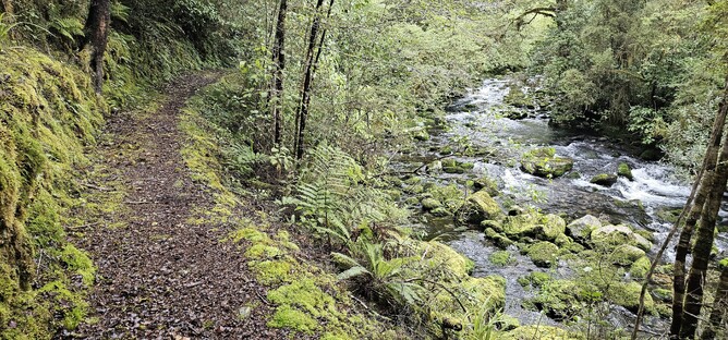
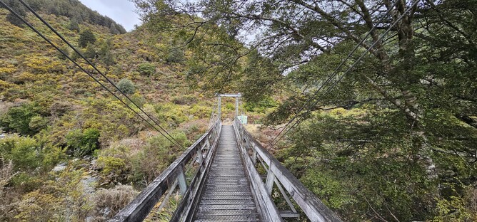
After crossing the bridge from the car park I took the right hand track. The Blue Creek Track starts off in the forest, following the stream along for a good portion of time. This is a historic mining area, so all the way along the lower section of the track there were old mining relics and descriptions for you to read and take a look at.
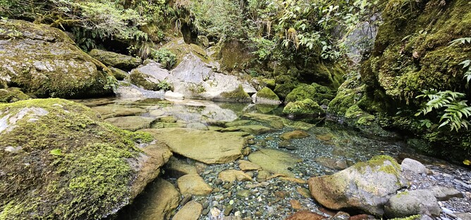
After around 20 minutes I arrived at the turnoff for a side trip to the Blue Creek Resurgence. Feeling pretty good, I decided I would take a look so I left my pack at the junction and headed off on the 10 minute walk to the viewpoint. There are a few steps and it is a bit slippy at times, but isn't far so I would recommend a visit if you are passing.
After the quick detour to the beautiful blue waters of the resurgence, I retraced my steps back to the turn off and the climb began!
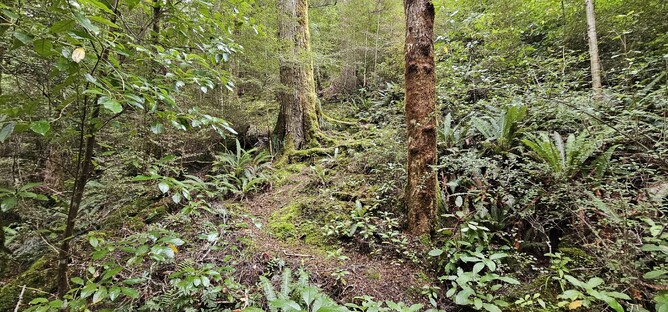
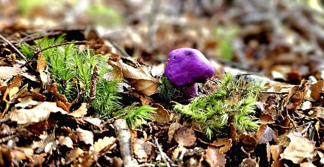
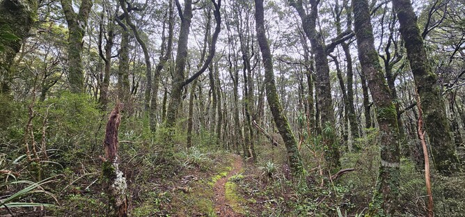
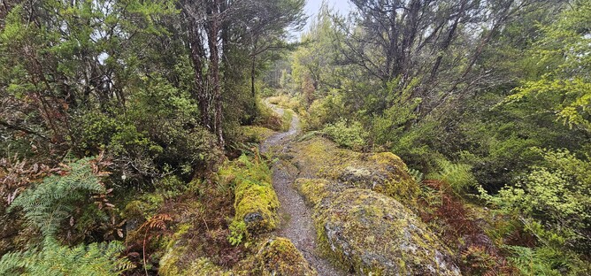
This section of the track takes you from the stream up to the ridge and connects up with the Ridge Track. It took me around and hour and 20 minutes to get up to the track junction, but somehow felt a lot longer. A relentless slog up through the bush, scrambling up roots and little muddy sections of track. Along the way there weren't too many views out, but it is a healthy New Zealand bush with lots of plant and birdlife to enjoy along the way, including some purple mushrooms.
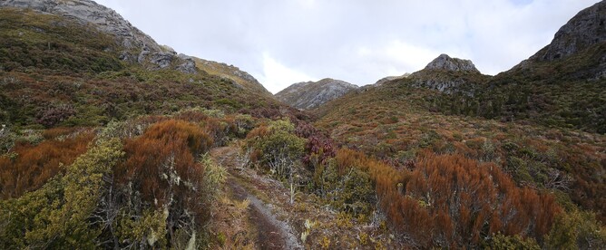
Seeing the sign for the junction with the Ridge Track was a pretty nice feeling and relieved I had a bit of renewed energy for the four hours that remained to the Hut. From the sign the track levels out a bit and leads out towards a more open section. There is still some elevation to be gained, but at a much kinder rate.
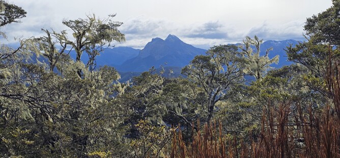
Approximately one hour after the junction I made it out onto the open tops, offering beautiful views out on to the green valleys below and tussocky hilltop. Most of the views are behind you at this point, so it is a good spot for a snack break and to top up the sun cream!
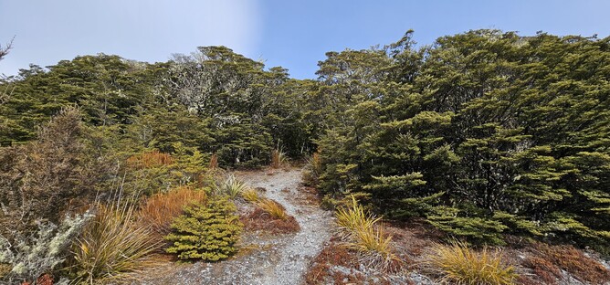
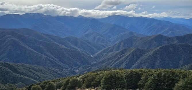
You are only really out in the open for around 15 minutes of walking. The track leads up over the top of the hill and then drops back down into the forest on the other side. From here there is a fairly long downhill section that becomes steeper as you progess.
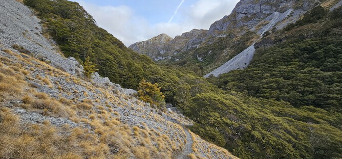
After around 15 minutes the bush starts to give way to more and more rocks and start to feel that you are approaching the valley floor. You don't actually go all the way down (thankfully) but as you reach the edge of the forest you get a glimpse of the cliffs that now tower above you on either side.
Fortunately for my now weary legs, this last section of the track is relatively flat. There is a bit of incline through the valley towards the hut, but it isn't dramatic and the track is pretty good, so you can concentrate on the views rather than the physical effort.
Every so often you drop back into bush for short periods, but then back into the open valley with beautifully coloured vegetation either side and incredible grey cliffs framing the view brilliantly.
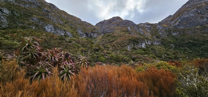
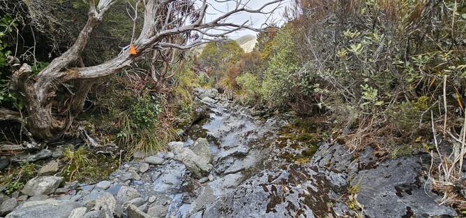
For a small portion of the track you drop into the river bed and have to follow along the rocks which is probably the more challenging of the terrain down here, but not at all problematic. Based on DOC timings I still had a couple of hours to go to the Hut so was taking things relatively steady through here and enjoying the views in all direction (taking way too many photos).
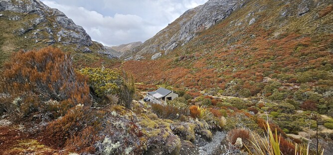
As I approached the end of the valley there was more purple coloured vegetation and you could see that the track was going to swing around to the right hand side. I hasn't been prepared for the fact that as soon as it did, I would be able to see the hut and instead of having to walk another hour, I would be there in 5 minutes. It was a welcome sight!
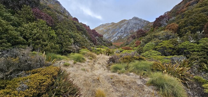
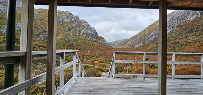
The picture below is from the entrance way to the hut and shows the final bit of track that you walk along. It is such a beautifully positioned hut with views up and down the valley. The summit of Mount Owen stands behind you and provides a great opportunity for exploration from the hut.
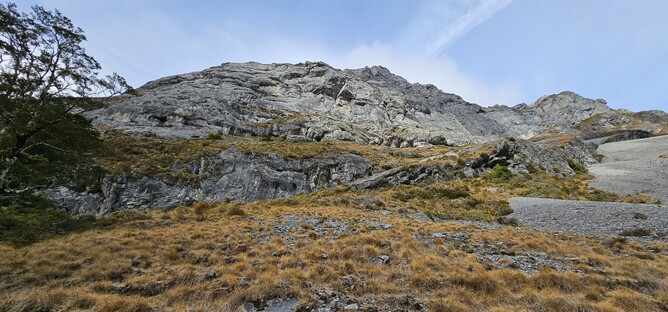
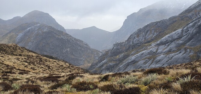
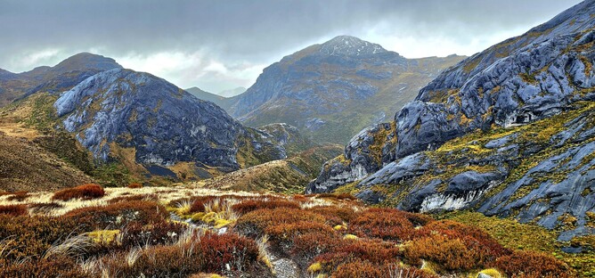
I did make an attempt to go to the summit the next day, but conditions had worsened and the rocks were slippy. Being alone, I had no desire to be stuck down one of the enormous cracks in the rock having slipped, so I went as far as I could without having to take unnecessary risks before turning around and starting the journey back out to the car.
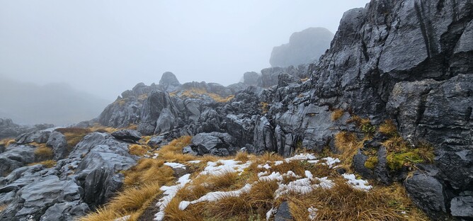
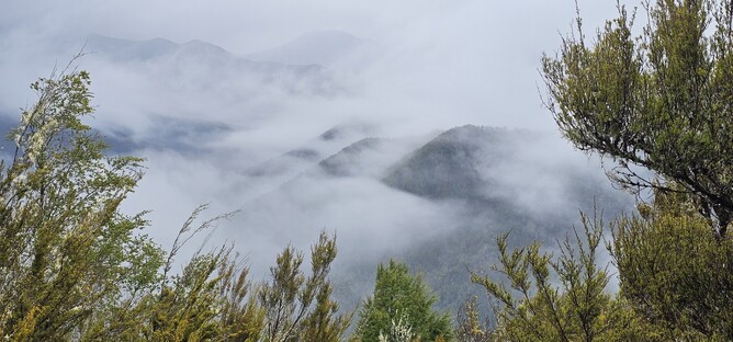
Whilst I may not have made it to the summit, the trip out there was well worth it for the additional valley views along the way. The photos below were taken between the summit and the hut on the way back. I can only imagine how beautiful it would be if it was a clear day, though I actually quite like the atmospheric shots.
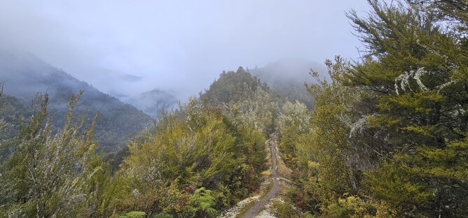
The return back out to the car park follows the same track back out through to the junction. From here I continued on to the Ridge Track, but sadly the fog hadn't really lifted much and so views were limited.
It was really good to go back the other way though as the vegetation was really different to the Blue Creek Track and it was nice to see out across the valley, even if it was a little misty.
For relatively long sections of the track you are skipping up and down along the ridge line, before it then drops relatively steeply back down towards the river. It was quicker than the way I came, but of course I was going down rather than up, so I would imagine the two tracks take around the same length of time no matter which direction you do them in. If you know you will have better weather on the way in than on the way out, then definitely start with the Ridge Track to make the most of the views.
Parking: It is possible to park at the Courthouse Flat Campsite at the end of the Wangapeka River Road. However, there is a ford that needs to crossed to reach this which can be impassable after rain, so it is worth checking the DOC website for updates. There are large sections of gravel road on the approach to the campsite but they are well maintained and wide.
Overnight Options: Granity Pass Hut is a standard 12 bunk hut. It is not bookable, so is first come, first served, but a standard Hut ticket is required.