5-7 hour return | 7.5km one way | West Coast (Fox Glacier)
This has to go down as one of the most under-rated places I have camped so far in New Zealand. I wasn't really planning to do it, but got lucky with three great weather days in a row on a four day trip to the West Coast, so started searching for additional options and stumbled upon this. I was certainly not disappointed and in fact, having read quite a few blogs around the length of time the walk took, I was also pleasantly surprised that it wasn't quite as strenuous as I had feared. That said, it is certainly is a physical challenge, so if you are after a slightly more relaxed option then maybe stick to the Alex Knob Track which offers similar views without the steep track up.
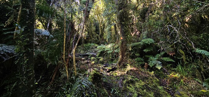
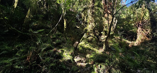
The track starts as it doesn't mean to go on...a nice flat section through some beautiful native bush, tracking along beside the Stony Creek for around 5 minutes. When you reach the opening and see the steep little hill marked by orange arrows below, that is the end of the flat for the remainder of the walk. So enjoy it whilst it lasts!
From here you start picking your way up through the bush towards the Trig (marked on the map as "Mt Fox") for around 2-2.5hrs. It is steep and pretty unrelenting, but that said it is all under canopy and so on a warm day like it was when I headed up the track, it was welcome cover from the sun.
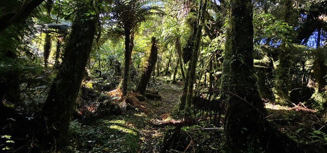
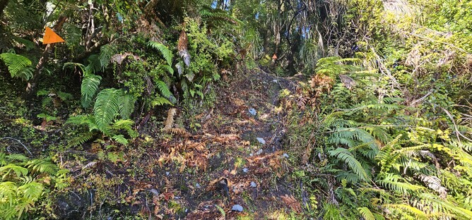
The track is well marked and really well worn, so as long as you don't lose concentration it is pretty easy to follow. I would say it is probably comparable to the Brewster Hut track, with the exception that there is no river crossing to start off with. There are a lot of roots and good foot holds to help with your ascent, and of course being the West Coast, it is fairly likely that you will encounter a reasonable amount of mud.
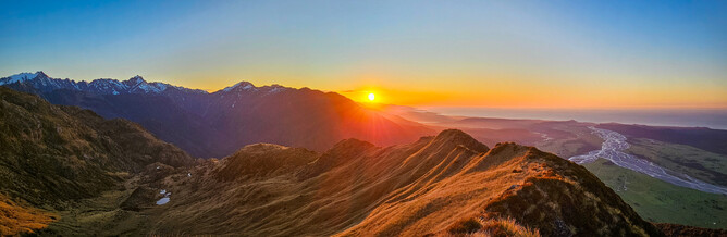
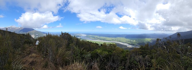
Shortly before you pop out to the Trig point, you do sense a lightening of the canopy and that you have nearly made it. There aren't too many gaps in the trees on your way to this point, so it is really awesome to get up to the Trig and be able to look back out over the braided river and onto the West Coast in one direction and then up to the Mount Fox summit and the Southern Alps behind in the other. I took a bit of a break here, thinking I still had a good distance to travel before reaching the summit. As it turned out, it took me less than 40 minutes to get from here to the summit (and that included me taking photos every two minutes as the view kept changing). However, from here you are more exposed and out of the tree line, so the break was well worth if for no other reason than to reapply sunscreen!
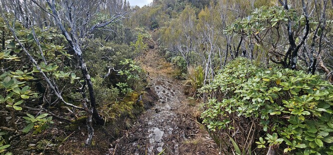
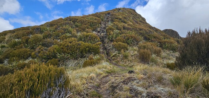
The mud ramped up from here, with sections of track that gave you no option but to walk through. It was a beautiful day, but the three days prior had rained, so I am not sure what it would be like after a period of dry weather (if such a thing exists). There is a short bush section before you get out onto the tussocks and can just track along the ridge towards the summit. Again the track is well defined and easy to follow, but there are also options to wander off the track to get some good other views which are worth taking if the conditions are good - you never know how it will look on the way down given how quickly the weather changes here.
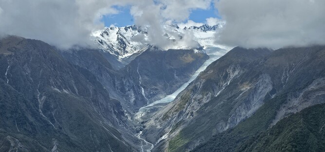
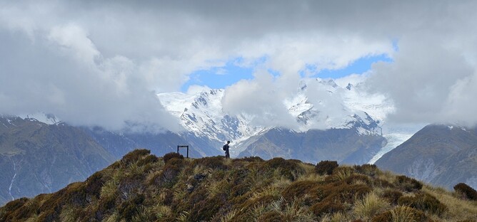
I only encountered one other person that day, a day walker heading up at around the same time I did which was a picture taken about 10 minutes above the trig. The forecast had been for some cloud to be hanging around through the middle of the day and then clearing in the evening. Unfortunately for the day walker, this was probably the best view he got of the glacier, which covered over completely whilst he sat at the summit eating his lunch. So if you are just going for a day, then it is a good idea to go early to get the best chance of a clear view.
Once out onto the tussocks, you are still ascending but it no longer feels like it. The gradient is certainly not as confronting as coming up through the forest and you are easily distracted by the views at this point so really don't notice the odd bump you are needing to go over. It was still reasonably muddy so part of my attention started turning to finding a suitable campsite in case it was just as muddy up at the summit.
Less than 3.5 hours from leaving the car park I made it up to the summit. The day walker had stationed himself near the sign to enjoy the views, so wanting to give him some space I continued on just beyond the summit up a little hill where I sat and ate my lunch looking back at the official summit and Fox Glacier in the background.
My fears around not finding a campsite easily where not wholly unjustified, with a lot of boggy sections and not that many flat areas. However, after a bit of searching I found a great little spot and set my tent up for the evening. The rain swept in as forecast and the view disappeared, so I took the opportunity for a well earned afternoon nap and waited for it to pass, waking up to a beautiful view as the sun started to heat up the tent, signaling to me that it was time to get back out and enjoy the mountains.
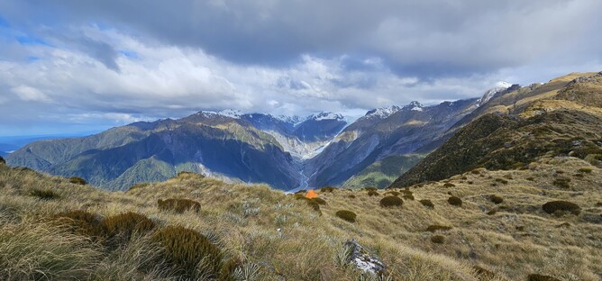
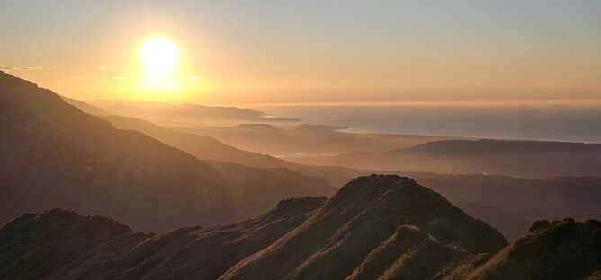
That evening was absolutely stunning. From my tent I had a great view out to the Glacier and out to the ocean. I had some time before sunset, so walked up the next peak (approximately one hour) thinking I might get an unobstructed view of the Alps. It did improve the view, but it wasn't the full panorama. I later learnt I needed to go one peak further and would have been in luck, so I know for next time! Instead I headed back down as the light started to change and enjoyed another spectacular West Coast sunset. My favourite spot was the little hill near the Mt Fox summit which is where I took the cover photo from for this blog. Having the snow capped mountains, braided river and ocean view is something that makes the West Coast (and particularly this little spot) so special.
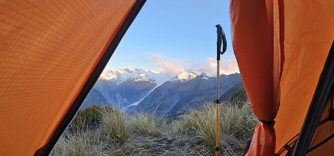
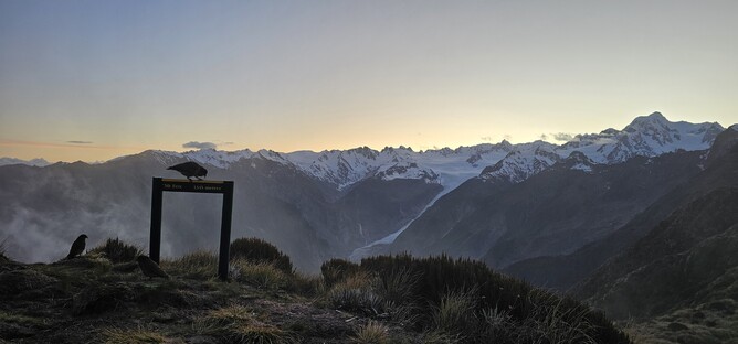
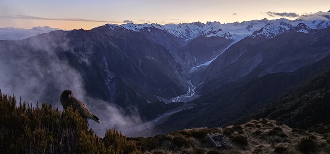
I was incredibly lucky with the sunset, but equally lucky with the sunrise the next morning. I awoke to crisp, clear skies and a beautiful red glow coming up over the glacier early the next day and was swiftly joined by a group of very vocal Kea who kept me company for the next couple of hours as I watched the sun come up and eventually (reluctantly) tidied my things away and made my way back down the mountain.
Some key things to remember about this track are that it is exposed once you get out of the tree line, so in poor conditions it wouldn't be much fun and there is a risk of losing your way if not equipped and skilled for that environment. The weather changes quickly here, so you need to be prepared for everything. Even though it was a stunning November day and I sweated the whole way up to the summit, when the cloud came over it was cold enough for a hail shower, so it can catch you out. Finally, there are no streams or rivers that you can access along the track or on the summit, so you need to bring water or find a tarn that you can drink from. Where I was, there were only small tarns that didn't look particularly appealing to drink out of, so fortunately my water supply lasted. That said, there were other bigger tarns further along so had I needed to, I would have found a suitable source of water.
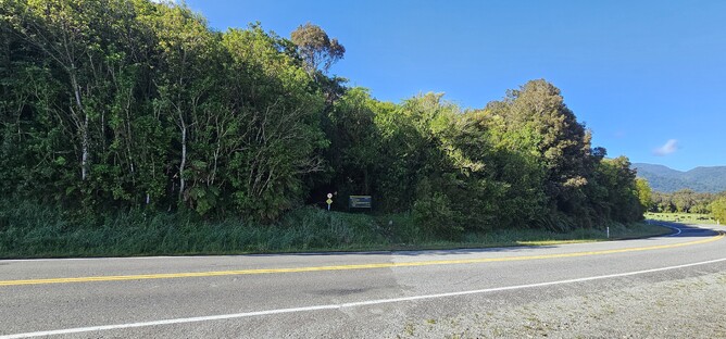
Parking is easy to spot at the side of the road and the track is well signposted. The walk down, whilst easier on the lungs than the walk up, was still hard work and slow going given how steep the terrain is. So I didn't save that much time on the way down compared to the way up (around 3 hours total).