6 - 8 hrs return | 5km one way | Mount Aspiring National Park
The Brewster Track has become a popular trail in the Makarora area of Aspiring National Park but shouldn’t be underestimated. It is a long day walk with a steep climb, but on a good day the views at the top are unbeatable! There is also the opportunity to extend the walk up to the Brewster Glacier, which is a further 1.5 hours from the Hut and offers views of the bright blue ice at the mouth of the Glacier and the phenomenally clear terminal lakes. This section of the trail is however unmarked and requires good route-finding skills and shouldn’t be attempted in poor conditions.
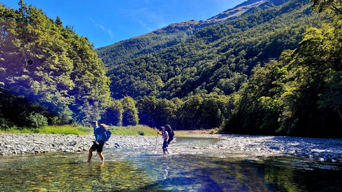
Your very first challenge on this track is the river crossing which occurs within 50m of the car park. This is the only crossing on the trail, but the conditions of the river can change quickly, and it can be impassable so make sure you check conditions before you leave and ensure you have enough gear with you to camp out on your return if it is not passable on the way back. The Mountain Safety Council website has great information about river crossings and checking the conditions.
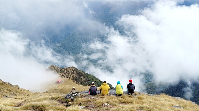
This wasn’t my first trip to Brewster Hut and on this occasion, I was there with four friends, two of whom were visiting from Europe for Christmas. We had booked two nights at the Hut on Christmas Eve and Christmas Day with the intention of a nice, relaxed trip to the Glacier on the middle day. Mother nature had other ideas however (and we don’t argue with her!) so we didn’t end up going all the way but loved it none-the-less.
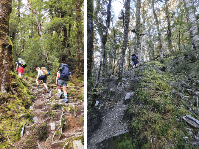
Once you are across the river, orange arrows indicate your way on to the start of the track. There is no warmup or easy introduction to this one – you are straight into the climb, and it is relentless! Climbing steeply through the bush on a well-marked track requiring a fair amount of scrambling up tree roots at times it is physically tough, but nothing too technical. It just requires you to take your time. Take the positive from you - you gain elevation very quickly! Very soon the sound of the river rushing through the valley below disappeared and all that remained was the sound of five hikers breathing heavily as they ascended, one foot in front of the other.

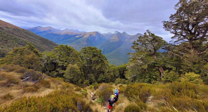
After around 1.5 hours we emerged at the tree line and opted to take a break here to enjoy the stunning scenery all around us. From here the track is marked with poles and winds its way across steep and ever more spectacular ridgelines. I have been fortunate that both times I have been here I have had good weather as I travelled in and out of the Hut and it hasn’t been particularly windy, but I imagine this would be a gnarly section if there were high winds and I would be thinking twice about continuing on.
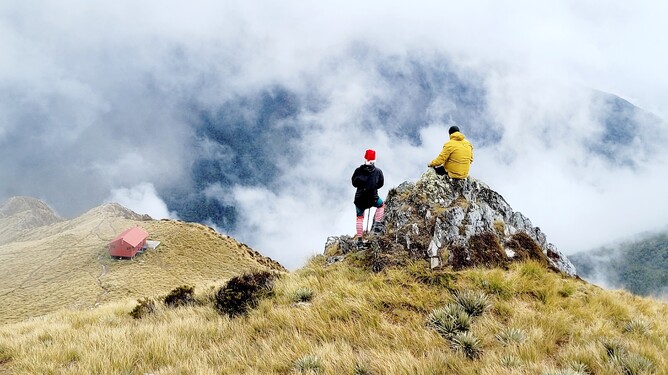
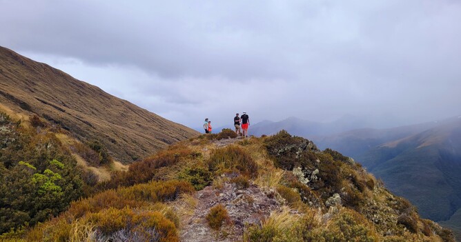
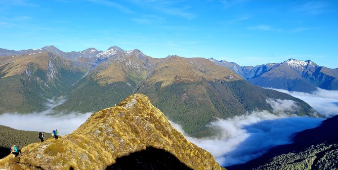
I love ridgeline views and so this section went by quite quickly as I tried to take in as much of the scenery around me as possible. It wasn’t quite as steep as what had already been covered, and on the odd occasion that it was steeper it didn’t last for long. There is an opportunity to branch off to the left and explore another little viewpoint out across the valley which only adds around 5 minutes to your journey and offers the view pictured here below. This isn’t marked but is quite well worn so you should spot it if you are looking and it offers nice views down to a Valley you don’t otherwise see from up higher.
Not long after this we approached the final climb and caught a glimpse of the Hut (well…the long drop at least) and buoyed with the additional energy of knowing that we had almost made it we marched up the hill double speed and were greeted with panoramic views of the Hut with Mountains towering up above. It is truly spectacular and is well worth the climb.
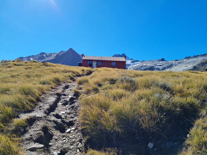
If you aren’t heading on to the Glacier, this is where your journey ends. There is water available at the Hut and a toilet so it’s a good place for a break before starting the descent. I really like the view up behind the Hut, so if you still have the energy to do so you can climb just a little way up the hill behind the hut and look back across the valley from there which offers a different perspective (pictured below).
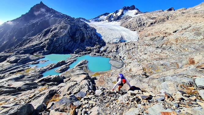
If you are continuing on to the Glacier then this is also where the track begins. There is a well-worn track most of the way up the initial climb before the route branches off to the left and hugs the mountainside as you move towards the next valley. Cairns mark the way, but there are other tracks that start from here as well so you need to follow your map and ensure that you are making your way to the viewpoint up above the Glacier. The picture below is from a different trip where we did go to the Glacier.
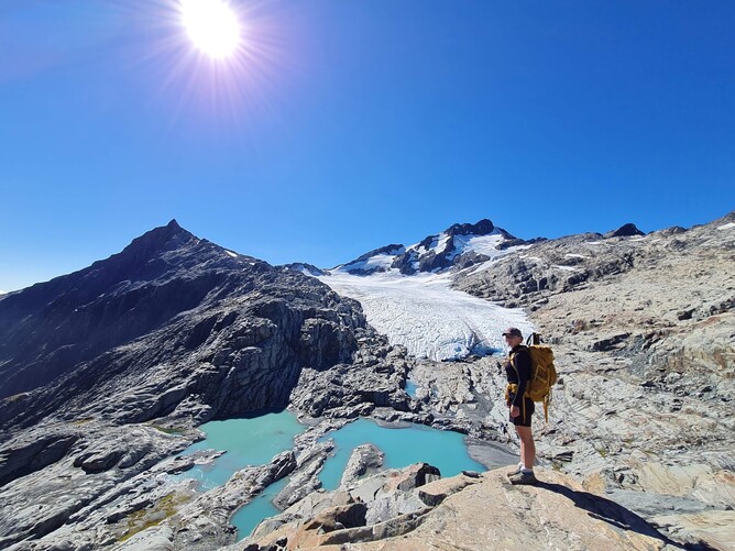
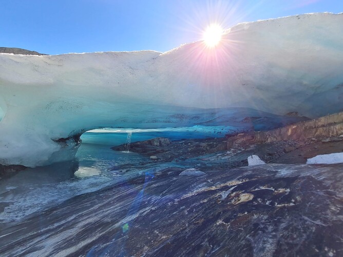
In wet conditions I wouldn’t proceed past here given the terrain and honestly the view here is one of the best. In good conditions however it is only around another 20 minutes to make your way down to the mouth of the Glacier. I took this picture (below) from the stream that flowed into the Terminal Lake just outside the entrance to the largest cave on my first trip – you could hear ice crashing down into the river that sweeps through the entrance which is quite an intimidating sound even when standing a safe distance away so it isn’t recommended to go inside. However, there are plenty of places to explore on the outside, with stunning views through the cracks in the ice into the Glacier.
On this visit we didn’t make it down to the Glacier as we had very different conditions, but you could see that a fair section of the entrance had fallen away and the river leading into the Terminal Lake had expanded.
From the Glacier we followed the same track back to the Hut. However, that is easier said than done and each time I have ended up on a slightly different path so getting the map out is a good idea to ensure you don’t drop too low into the Valley and have to retrace your steps as it isn’t passable. There are some tricky sections which require careful assessment of conditions before attempting as the consequences of a mistake would be severe, so before deciding to do this track make sure you have done your research and are confident with the terrain and skills required or go with one of the guided groups.
I think it is well worth staying overnight at Brewster Hut, or camping up at the Glacier Viewpoint as this is such a beautiful area that experiencing it for longer than a day will never disappoint. And if like me, you love seeing Kea then you are likely to be rewarded with an early morning wake up call if staying in the Hut as they tend to descend on the deck and announce their arrival to get you out of bed nice and early!
Parking: Park at the Fantail Falls car park.
Overnight options: Brewster Hut is a serviced 12 bunk Hut bookable on the DOC website. It is also possible to camp here.